Bramley Community Area Profile

Last updated November 2026. If you notice any information that is out of date, please email community.development@basingstoke.gov.uk

This community area profile captures key facts about community assets, community groups and activities in the ward of Bramley. It aims to be a useful reference for local services and community groups looking to understand the strengths and assets in the ward.

The ward of Bramley is made up of several parishes:

  • Bramley a village in North Hampshire, comprised of three previously separate communities Bramley, Bramley Green and Bramley Corner. All of which straddle The Street and Sherfield Road between the A33 and the A340.
  • Mortimer West End a village to the west of Mortimer and just within the borders of Hampshire.
  • Hartley Wespall a small village close to border with Berkshire.
  • Sherfield on Loddon a village including the hamlets of Church End and Wildmoor.
  • Silchester a village most known for the Roman town of Calleva Atrebatum and its archaeological site.
  • Stratfield Saye a village including the hamlets of West End Green to the west, Fair Oak Green in the south west and Fair Cross in the north.
  • Stratfield Turgis a village including the hamlets of Spanish Green and Turgis Green.

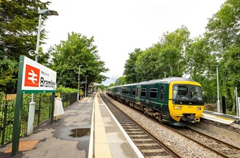
Bramley CAP - Train

Population

10,094 (Census 2021)

Demographics

Within the ward:

  • 65.2% are economically active* in employment (age group over 16 years), 2.4% are economically active* but unemployed and 32.5% are economically inactive**. This compares to a borough average of 63%, 2.4% and 32.5% respectively.
  • Educational attainment shows 12% having no qualifications compared to a borough average of 14.2%
  • The levels of health are reported as very good 54.6% and good 39.1%, compared to the borough average of 50.1% and 35%
  • The ethnic makeup has the majority being white 94% with 6% other ethnicities compared to a borough average of 88.5% and 11.5%

View more demographic information at the Office for National Statistics

*Economically active – People who are either in employment or unemployed
**Economically inactive - People who are neither in employment nor unemployed

Community groups and communication channels

Facebook pages and groups

Bramley
Silchester
Sherfield on Loddon
Stratfield Saye

Newsletters and magazines

The Loddon Valley Link is delivered free to homes in Sherfield on Loddon, Stratfield Saye, Hartley Wespall and Stratfield Turgis. The magazine can be collected from various points in the ward.

Bramley
The Bramley Magazine covers the villages of Bramley and Little London.

Mortimer West
Published by Mortimer Village Partnership. The Mortimer West End Newsletter is distributed twice a year in February and October.

Silchester
The Silchester Village Magazine is published independently monthly for Silchester residents. The magazine has an annual subscription and provides updates on community events, important updates and contact information for local businesses.

Noticeboards

There are multiple community noticeboards across the parishes.

Voluntary and community sector organisations in the area

Mortimer West End

The Mortimer Village Partnership covers both Mortimer West End and Mortimer.

Sherfield on Loddon
Silchester

Community venues

Bramley
  • Bramley Village Hall, The Street, Bramley, RG26 5BP. Run by a group of trustees, the hall hosts activities such as fitness/sport, children’s groups, village market.
  • Clift Meadow and Brocas Hall, Minchens Lane, Bramley, RG26 5BS. Community areas run by local volunteer trustees. The hall hosts a variety of activities such as fitness/sport, social groups, children’s groups, community café.
Mortimer West End

Mortimer West End Village Hall, Church Road, Mortimer West End, RG7 2HU. Run by the Mortimer Village Partnership, an independent group of volunteers, the hall hosts a variety of activities, groups and classes such as arts, events and fitness.

Sherfield on Loddon

Sherfield on Loddon Village Hall, Reading Road, Sherfield Green, Sherfield on Loddon, RG27 0EZ. The hall hosts a variety of activities, groups and classes such as music, arts and crafts, fitness, lunch clubs.

Silchester

Silchester Village Hall, Whistlers Lane, Silchester, RG7 2NE. The hall has a theatre and runs a variety of activities, groups, classes and a village market.

Stratfield Saye

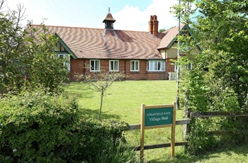
Stratfield Saye Village Hall, New Street, Stratfield Saye, RG7 2EL. The hall is run by the parish council. The hall is available for hire.

Bramley CAP - Village Hall

Leisure, sport and recreation

Bramley
Mortimer West End

Mortimer West End Cricket Club, Church Road, Mortimer West End, RG7 2HY

Sherfield on Loddon
Silchester
Stratfield Turgis

Stratfield Turgis/Hartley Wespall Cricket Club, The Green, Stratfield Turgis, RG27 0AE

Arts, heritage and culture

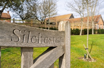
Bramley CAP - Gate sign

Faith based venues offering wider community activities

Bramley

St James Church and Cross House, The Street, Bramley, RG26 5DF. This venue offers lunch clubs and private events.

Sherfield on Loddon
  • St Leonard’s Church, Sherfield on Loddon, Hook, RG27 0JB. This venue offers a warm hub and memory café.
  • Sherfield on Loddon Baptist Chapel - 3 Breach Lane, Sherfield on Loddon, Hook, RG27 0AW. This venue offers twice weekly social groups.
Silchester

St Mary the Virgin Church, Church Lane, Silchester, RG7 2HH. This venue offers coffee morning and bellringing.

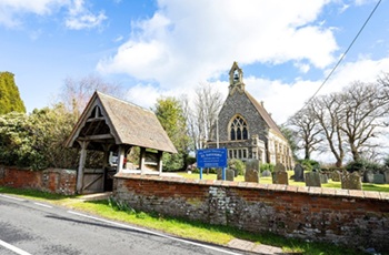
Bramley CAP - Church

Pre-schools and nurseries

Primary schools

Secondary schools

The nearest secondary school to:

Special educational needs

  • Loddon School, Wildmoor Lane, Sherfield on Loddon, Hook, RG27 0JD

Private schools

  • Sherfield School, Sherfield on Loddon, Hook, RG27 0HU. For children aged 3 months to 18 years old

After-school and holiday clubs

Health provision

The catchment areas for Chineham Medical Practice, Tadley Medical Partnership and The Mortimer Surgery also cover parts of this ward.

Other service providers working in area

There are various housing providers who have stock within the ward. These are Abri, English Rural, L&Q, SNG and Vivid.

Open spaces and play areas

Bramley

There are play areas in Bramley at:

  • Farriers Close
  • St. Marks Close
  • Yew Tree Close
  • Beckett Garden
  • Leighton Close
  • Bramley Green
  • Cinder Track
  • Bromelia Close
  • Campbell Road
  • Clift Meadow
  • three play areas on German Road housing development.

There are several green areas including Forge Field at Farriers Close, Longbridge Road and Moat Close field.

Mortimer West End

Has a recreation field, with playing fields with play area.

Sherfield on Loddon

Has a community tennis court, playing field and play area.

Silchester

Has a recreation ground including a play area, playing fields, a cricket pitch and pavilion.

The village also has Silchester Common, a site of special scientific interest that is one of the few remaining lowland heaths.

Turgis Green

Has a playing field with cricket pavilion and play area.

Allotments

There are allotments located in:

  • Bramley close to St James’ Church
  • Sherfield on Loddon at Bow Gardens
  • Silchester at Grays Meadow, Silchester Road and St James Park

Biodiversity

Our Natural Environment Team is involved in a range of work that protects and enhances the borough’s landscapes and habitats, such as developing strategic guidance including the Green Infrastructure Strategy, our Biodiversity Strategy and the emerging Tree Strategy

Read the Biodiversity Strategy

Within this ward there are:

  • two Sites of Special Scientific Interest (SSSI)
  • 94 Sites Important for Nature Conservation (SINC)
  • one local nature reserve (LNR)
  • 26 local green spaces (LGS)
  • one road verge of ecological importance (RVEI)
  • 76 ancient woodlands
  • 1841 parcels of priority habitat, including floodplain grazing marsh, lowland meadows, lowland mixed deciduous woodland, lowland heathland, lowland dry acid grassland, wet woodland and wood pasture and parkland.
Details about the types of sites

Site of Special Scientific Interest (SSI) - a nationally designated site valued for its biodiversity or geology.

Sites Important for Nature Conservation (SINCs) – locally designated sites of value for their biodiversity. They must be considered in any planning application.

Local Nature Reserves (LNR) – a national designation for biodiversity and public access. Local authorities declare them and generally own and manage them.

Local Green Spaces (LGS) – introduced in 2012 NPPF and provide the same level of protection as Green Belt to areas of green space that are particularly valued by their local communities.

Road Verges of Ecological Importance (RVEI) – identified by the Hampshire Biological Information Centre. The verges support either a notable species and/or a species rich semi-natural habitat.

Priority habitats – habitats of ‘principal importance’ listed within in the UK Biodiversity Action Plan (UK BAP) as required under Section 41 of the NERC Act 2006. Also known as ‘S41 habitats’.

The Wilder Bramley Facebook group are a community group dedicated to promoting and increasing biodiversity, sharing advice on being sustainable and discussing local environmental issues.

The Hampshire and Isle of Wight Wildlife Trust, with funding from the Environment Agency, have published a biodiversity strategy for the Loddon catchment area. The area includes parts of Hampshire, Berkshire and Surrey, including Basingstoke and Deane, Hart, Rushmoor and Wokingham.

Silchester Common is a site of Special Scientific Interest. It is managed by Silchester Parish Council with a working party of local volunteers.
Other local facilities

There are a range of shops:

  • Bramley includes a convenience store with post office, a bakery and Farm Shop/Café
  • Sherfield on Loddon includes a convenience store and coffee shop

There are no shops in Silchester or Mortimer West End. There are hairdressers, takeaway, convenience store, pharmacy, a café, and travel agent in nearby Mortimer.

There are eight pubs located in Bramley, Sherfield on Loddon, Stratfield Turgis and Silchester.

Transport

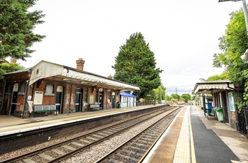
Bramley CAP - Train station

Trains

  • Bramley has a train station, which runs a half-hourly service between Basingstoke and Reading. The service also serves Mortimer, the closest train station to Mortimer West End.

Buses

  • Bramley Ward is served by one Stagecoach bus route. The number 14 service connects Basingstoke with Sherfield on Loddon and Bramley. The service also serves Silchester twice daily. There are seven buses a day from Monday to Saturday.
  • Mortimer West End has one bus service to Reading, which runs every 30 minutes during the day.

Car shares and community transport schemes

Cycling

  • National Cycling Route 23 runs from Reading to Sandown via Basingstoke, Alresford, Winchester, Eastleigh and Southampton. The first part of the route between Reading and Basingstoke, also known as the Calleva Trail, passes through Stratfield Saye, Silchester and Bramley

Green infrastructure and climate change

View our green infrastructure strategy

Our Green Team are engaging with residents, communities and organisations in the area, including through events, the parish council and offering residents home energy surveys.
Find out more about the Green Team

Other local groups include:

Future development, planned works or consultations

Bramley, Sherfield on Loddon and Silchester have neighbourhood plans in place. Find neighbourhood plans on our website

Recent ‘Large Scale Dwelling’ planning applications received for:

Planning was approved in 2021 for 302 residential dwellings at Upper Cufaude.

Find current information on planning applications

Parish Councils in the ward also have information on their websites about current planning applications and consultations.

Bramley

  • Upper Cufaude Lane – 350 homes along with community centre (375 sqm)
  • Razors Farm – 300 homes
  • Bramley View – 65 houses
  • Calleva Rise – 11 bungalows

Sherfield on Loddon

  • Longfield Place – 200 homes
  • Sherfield Hill Farm – 350 homes

Political representation

Find details of ward councillors representing the area
Find details of Hampshire County Council Councillors

The ward is within the North East Hampshire constituency.

Find details of your local MP

Parish councils

Other local information

Hampshire Constabulary Business Objects data shows that over the past five years the number of crimes and incidents of anti-social behaviour reported to the police in Bramley and Sherfield have fluctuated. There has been an overall reduction of 8% in reported crime since 2021/22 and a 44% reduction in anti-social behaviour.

Police recorded
incidents by year
2021/22 2022/23 2023/24 2024/25 2025/26
Crime 276 240 255 203 253
Anti-social behaviour 48 29 47 35 27

In Bramley and Sherfield the most common types of:

  • Crime recorded over the past five years, have been violence against the person, theft offences and public order.
  • Anti-social behaviour reported to the Police over the past year was youth related anti-social behaviour.

The Community Safety Partnership (CSP) is working hard to tackle crime and anti-social behaviour across the borough. The current priorities for the partnership are:

  • improving feelings of safety and health outcomes within the CSP area
  • serious violence
  • domestic abuse
  • anti-social behaviour
  • Town Centre and business crime and anti-social behaviour.

Many actions are being undertaken in relation to these priorities and to address the issues seen locally.

Find out more about the Basingstoke and Deane Strategic Assessment

Our Community Safety Patrol Officers focus on anti-social behaviour affecting people and places.

Help us improve our website

If your feedback is about a council service, please get in touch using our Contact us form

Sign up for email updates

Receive information on council services, news and events by email.

© 2026 Basingstoke and Deane Borough Council